Why Cities Form Grids
A street grid makes land and movement legible. Its exceptions show what a plan had to accommodate.
Lay a finger on one junction in a street map. Move it two blocks east and one block north. If the blocks repeat, the route is easy to describe, and a second route can reach the same point in a different order. At map scale, this predictability is one attraction of the grid. It provides a way to locate both destinations and the land in between.
In the Library of Congress’s 1811 commissioners’ map of Manhattan, straight streets and avenues spread a regular scheme across much of the island. The proposed network meets an irregular shoreline and the street fabric farther south. You can see the drawing negotiate the places where a simple rule encounters ground with its own shape and history.
A grid makes several promises
For someone drawing a plan, a repeating block can make subdivision easier to describe. For someone walking through it, repeated intersections can make distance and direction easier to estimate. A rectangular grid can also provide several routes between destinations. Each of these benefits depends on details the drawing abstracts away. A wide crossing can delay a walk. A fenced parcel can interrupt a nominal connection. A row of identical block outlines can contain wildly different streets.
Block proportions change how the network feels. In an elongated grid, crossing a short block and crossing a long one are different commitments of time. Turn a map ninety degrees and the geometry gives you a new orientation. Try the same turn on foot and the difference between the two street directions can become obvious.
Cut a corner
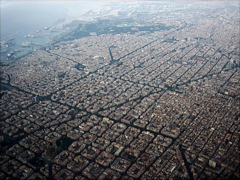
In Barcelona’s Eixample, chamfered block corners widen the intersections. From above, the cut corners give the blocks a recognizable outline. At ground level, they change the edge of the street where several paths come together. Avinguda Diagonal cuts obliquely across the regular blocks, creating places that are difficult to describe by a simple count of north–south and east–west moves.
The schematic strips this idea down to one diagonal crossing a set of rectangular blocks. It is an illustration of a geometric effect, without the names, distances or local alignments needed for a map. A diagonal changes routes and makes odd-shaped pieces of land at the same time.
Read the plan at two heights
From high above, a grid is an arrangement of lines. At eye level, it is also shade, slope, surface, crossing time and the sequence of doors along a block. Both readings are useful. When a grid seems perfectly regular on paper, zoom in on a junction near its edge or follow a street that runs at an angle. The way the repeated pattern ends often says more about a city than the repetition itself.